
Drone wreck found near Moșești, Buzău, 21 Oct 2026
A farmer found drone wreckage in a field near Moșești, Buzău County, on October 21, 2026. Officials have not said what it was, where it came from or when it fell.
AirVeto finding: Three accounts on 21 October date the same wreck three ways: the prefect calls the fall recent, Digi24 reports it came down days earlier unseen by radar, and ProTV says the defence ministry thinks the pieces may belong to an older incident.
- confirmed Buzău prefect Leonard Dimian said the fall was recent and not days old, and that the aircraft did not appear to have been intercepted. Opinia Buzău
- reported A Digi24 journalist's information is that the drone fell days earlier and was not detected by the defence ministry's radars. Digi24
- reported ProTV says the defence ministry estimates the fragments may come from an older incident, not a recent crash. Știrile ProTV
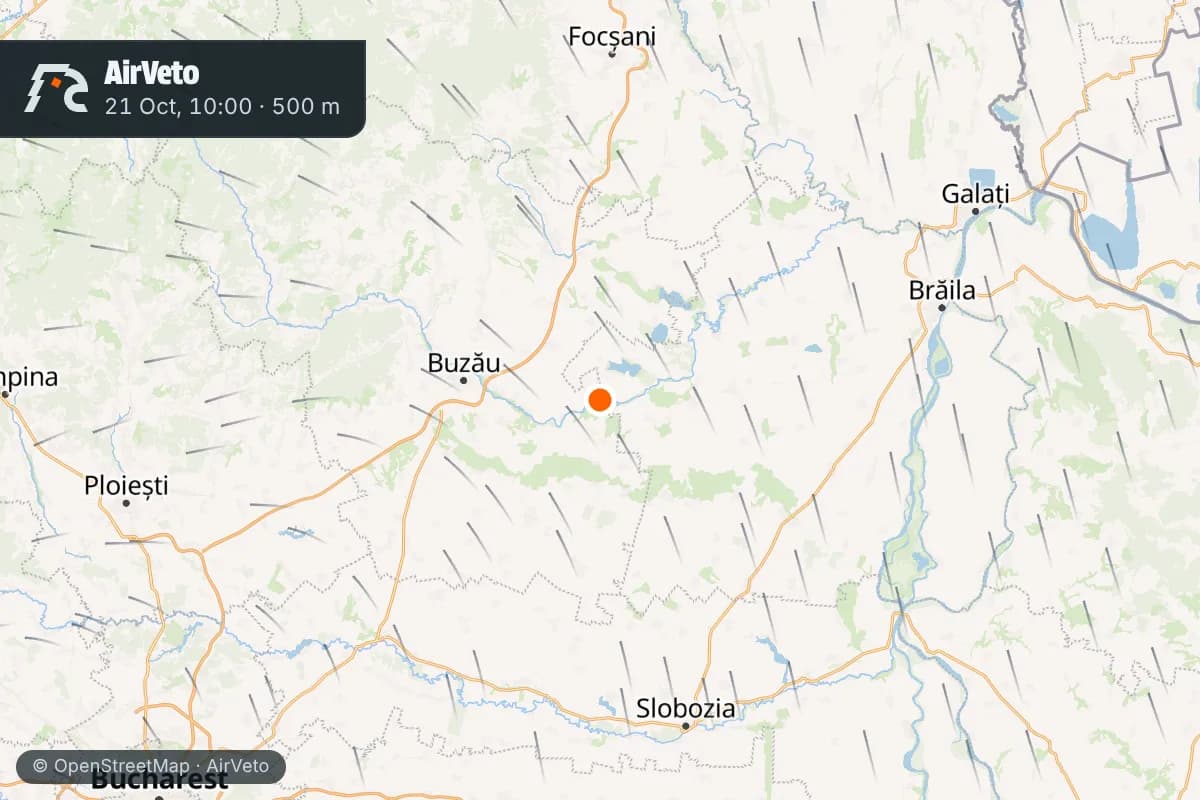
- modelled The field is 31.8 km from the Padina shootdown site of July 24 and 96 km from Reni, Ukraine. AirVeto methodology
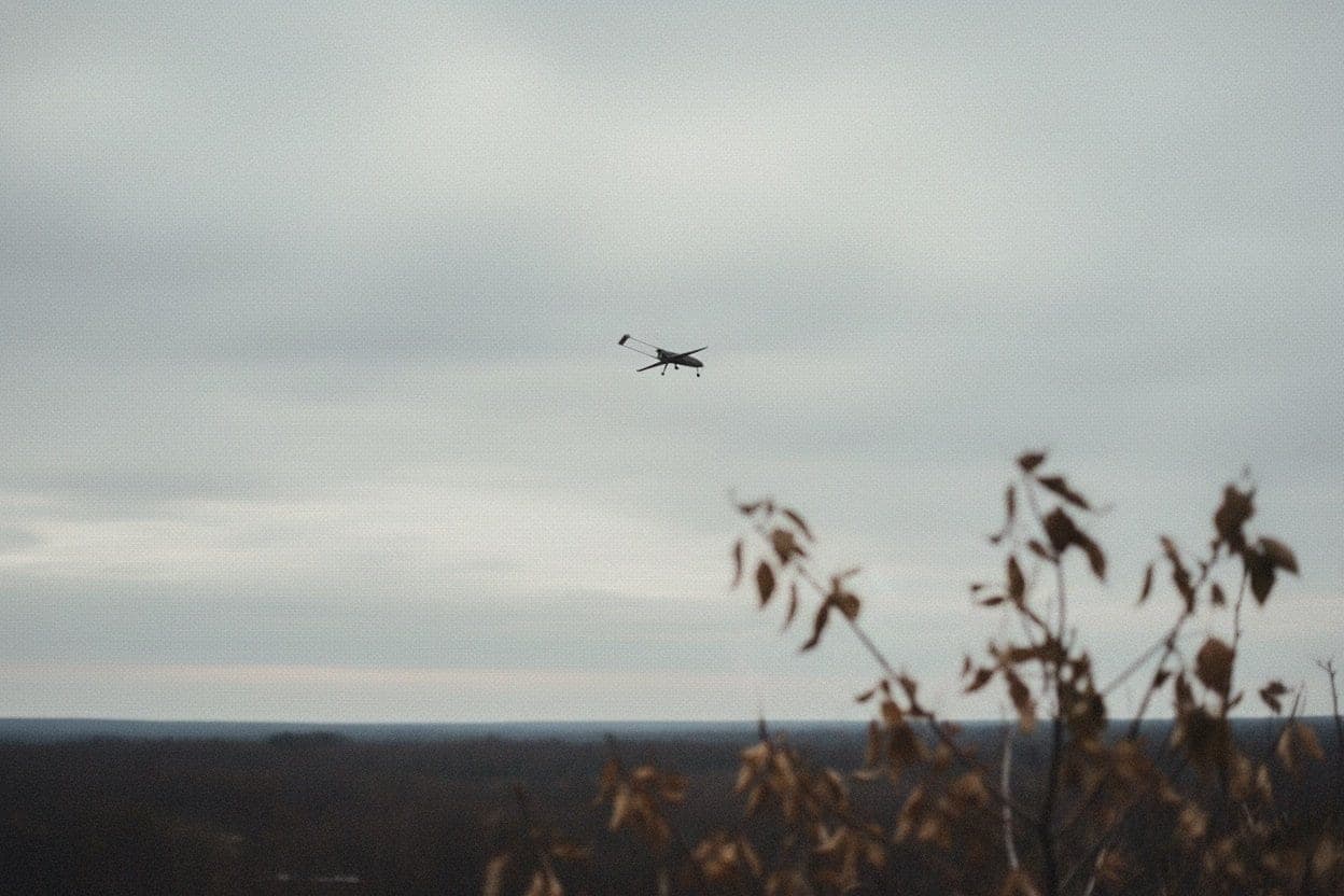
A farmer found drone wreckage in a field outside Moșești, in Buzău County, southeastern Romania, on October 21, 2026, and called 112 at 11:28 local time, Buzău prefect Leonard Dimian said (Buzoienii.ro gives 11:48). Three accounts of that day date the fall three different ways, and none of them is a final official finding.
The prefect says the fall was recent, and Digi24 says it was days earlier
Dimian told reporters the pieces include part of an engine, part of the fuselage and some propeller elements, scattered over about 100 square meters. He said the fall was recent, not from a few days ago, and that the aircraft did not appear to have been intercepted.
Digi24 reported different information. Its journalist Valentin Stan, citing information he had, said the drone reportedly fell days earlier, not overnight or on October 21, and that the defence ministry's radars did not detect it.
Știrile ProTV reported that the ministry estimates the fragments may come from an older incident.
The village mayor, Domnica Vlad, told News.ro through ProTV that she does not know when it fell. She said residents often hear booms and aircraft noise, and she could not tie either to the wreck.
Officials have not named the drone, its origin or its owner
The prefect said the origin cannot be established from the parts found on the ground. He said none of the pieces carry markings, unlike the debris from the July shootdown at Padina, and that specialists called that odd. Digi24 later quoted the farmer as describing yellow numerals on the drone, so the markings question is open. No explosive was found.
The defence ministry (MApN) and the intelligence service (SRI) sent specialists, who searched for about four hours before pulling back, Digi24 reported. Dimian said the search area would be widened well beyond the first 100 square meters.
The farmer was plowing about one kilometer from Moșești when he saw the pieces, Buzoienii.ro reported. Locals say only the fuselage and engine were left and that passersby may have carried off other parts, Radio România Actualități reported. The ministry's own 2026 count, as Radio România Constanța gave it, is 35 unauthorized drone entries into Romanian airspace in 2026 and 44 drones or fragments found, collected or neutralized.
The field lies 31.8 km from the Padina shootdown site and 96 km from Reni
By AirVeto's measurement the field is 31.8 km in a straight line from the Padina shootdown site of July 24. A Romanian F-16 brought a drone down there, and it is the only incident in AirVeto's archive within 60 km. The field is 96.0 km from Reni, a Ukrainian town on the Danube.
That puts the find well inland. On the morning of October 21 an RO-Alert went out for northeast Tulcea County after radar picked up a group of targets northeast of Vâlcove, in Ukrainian airspace. The ministry said none entered Romanian airspace. Nothing published so far connects that alert to the Moșești wreck.
The wind at 500 m blew from the southeast at 20 km/h
AirVeto's wind model gives the center-point wind over Moșești at 10:00 local time on October 21, the morning of the find. The fall date is not known, so these values describe that morning and not the flight.
| Altitude | Wind from | Speed |
|---|---|---|
| 500 m | SE | 20 km/h |
| 2,000 m | SW | 19 km/h |
| 3,000 m | W | 23 km/h |
Directions are where the wind blew from.
This reconstruction is based on reporting by Digi24, Opinia Buzău, Radio România, DailyBusiness and ProTV, and on AirVeto's wind-model data for the event window. How the model is built is on the methodology page. Every drone and airspace event AirVeto has reconstructed along the EU's eastern border is in the incident archive.
Sources
- Digi24 - Resturi de dronă în județul Buzău. Prefect: „Astea sunt vremurile în care trăim” (21 Oct 2026)
- Opinia Buzău - Ce au găsit specialiștii pe câmpul din Robeasca. Prefectul: „Prăbușirea este recentă” (21 Oct 2026)
- Radio România Actualități - Buzău: Drona găsită prăbușită pe câmp nu a fost doborâtă de forțele aeriene NATO (21 Oct 2026)
- Radio România Constanța - Dronă prăbușită, fără elemente explozibile, descoperită pe un câmp din județ (21 Oct 2026)
- DailyBusiness - Dronă prăbușită pe un câmp din Buzău. MApN și SRI verifică resturile (21 Oct 2026)
- Știrile ProTV - Un fermier a găsit resturi de dronă pe un câmp din Buzău (21 Oct 2026)
- Buzoienii.ro - Prefect Buzău: S-au găsit părți din motor, fuzelaj și elice (21 Oct 2026)
- Methodology