

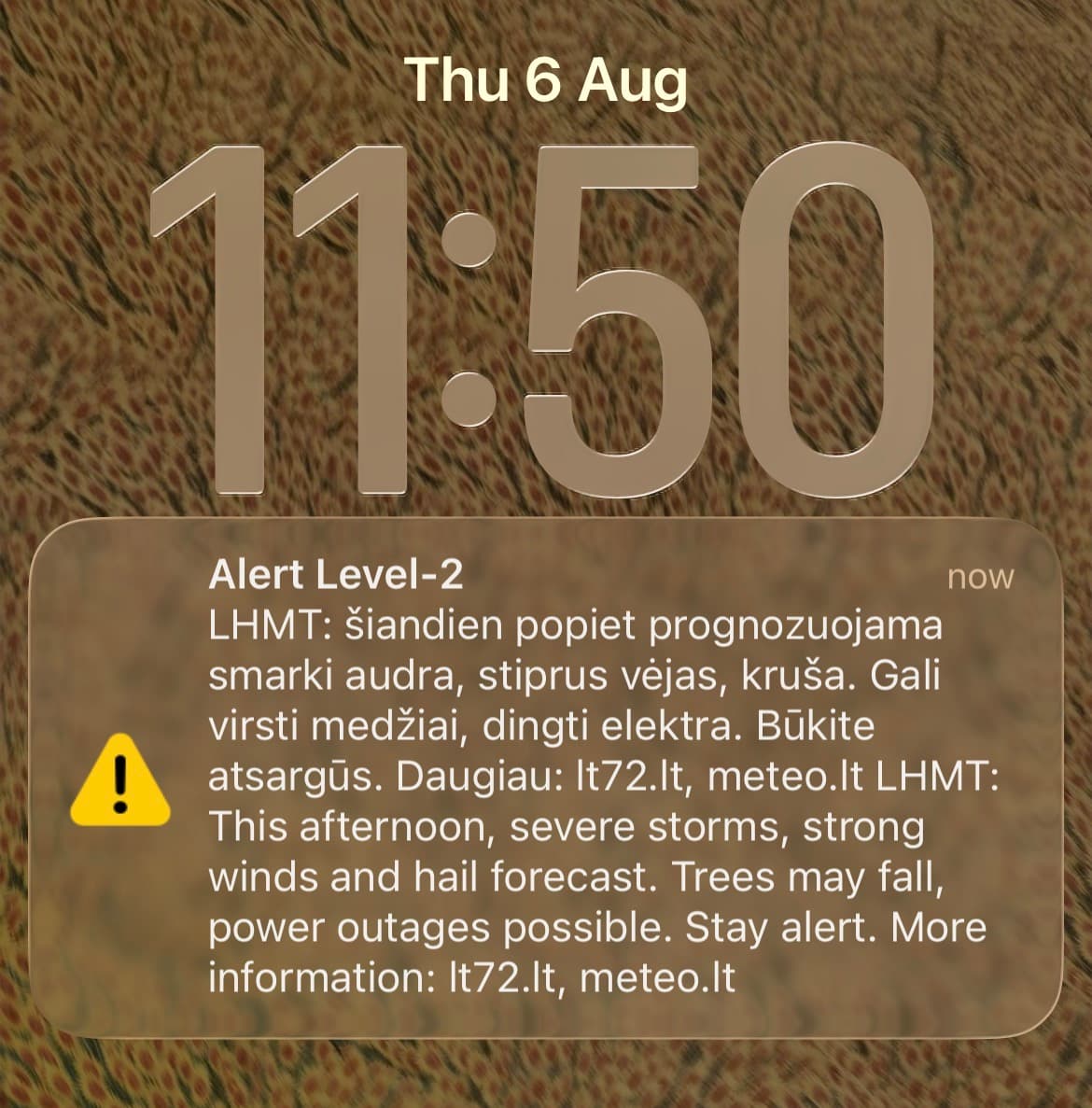
On the afternoon of August 6, 2026, Lithuania's hydrometeorological service (LHMT) pushed a Level-2 storm alert to phones nationwide, distributed via the lt72.lt emergency system and meteo.lt: severe storms, strong wind, hail, trees down, power out. The afternoon passed without a significant storm. Five days earlier, Vilnius flooded and nobody's phone rang at all - and that gap, not the storm itself, is what makes August 6 worth reading.
The flood LHMT didn't warn anyone about
On Saturday August 1, 2026, roughly 35 mm of rain fell on the Vilnius region in a few hours - close to half of what the city normally sees across the entire month of August. Streets went under. So did underground garages: Vilius Ankėnas, who heads surface-water management at Grinda, the municipal company that maintains Vilnius's streets, told LRT that crews pumped roughly 2,000 cubic meters - about 2 million litres - out of a single underground garage in 12 hours. Grinda logged around 500 calls from residents that weekend, about 150 of them storm-related: flooded streets, flooded underground garages, blocked drains, downed trees. The Bukiškis viaduct in Avižėniai flooded badly enough to cut the road and isolate part of Vilnius district until late Sunday.
Ankėnas said Grinda's specialists saw the storm coming and reinforced their crews in advance. No SMS alert went to residents' phones. 15min.lt ran the story under a direct headline: why didn't Vilnius residents get a warning about the approaching storm?
What explains the August 6 alert
The straightforward reading is not that LHMT flipped from careless to overcautious for no reason. It is that the criticism itself did the work. Once a forecaster has been publicly blamed for staying quiet through real damage, the incentive on the next uncertain afternoon shifts hard toward sending the alert - a false alarm costs almost nothing, while a second unwarned flood, so soon after the first, would cost a great deal more. That is a rational institutional response to public pressure. It has little to do with how much the risk on August 6 resembled the risk on August 1.
This is a well-documented pattern in risk communication generally, not something specific to LHMT: agencies that get criticized for under-warning tend to over-warn immediately afterward, regardless of whether the underlying risk changed. The alert on August 6 is evidence of what happened on August 1 - not independent evidence about the weather on August 6.
A year earlier, the same incentive produced silence
The Vilnius flood is not the only recent case where Lithuania's public-facing warning systems said nothing while something real was happening. In the early hours of July 28, 2025, an unidentified drone crossed into Lithuania from Belarus at roughly 200 meters altitude and was tracked toward Vilnius - residents filmed it flying over parts of the capital. It then disappeared from view, with no public warning issued while it was airborne. The aircraft was not located until 1 August, five days later, at the Gaižiūnai military training ground in Jonava district, about 100 km from the Belarus border. Lithuania's Prosecutor General's office identified it as a Russian-made Gerbera drone carrying approximately two kilograms of explosives, neutralized on site - the second Belarus-launched drone to cross into Lithuania that week; the first had crashed near the border on July 10, 2025.
That incident illustrates the other half of the same incentive structure: before a failure has been publicly attributed to an agency, there is little institutional pressure to raise an alarm over an uncertain, in-progress event - even one involving live explosives over the capital. The pressure only appears after the fact, and only if the failure becomes visible.
What this means for reading any alert system
For AirVeto's audience, the useful takeaway is not about Lithuanian weather policy specifically. It is that an alert's timing tells you more about an institution's recent political exposure than about the risk it claims to describe - alerting cadence is a lagging response to public pressure, not a leading indicator of danger. AirVeto's live wind map exists precisely because it does not run through that filter: the data is there whether or not anyone has decided the moment warrants an SMS.
The Live Map
AirVeto's live wind map shows current conditions over the Lithuania-Belarus border zone in real time, independent of any alert threshold. AirVeto's account of the events described here is sourced from LRT, 15min.lt, AeroTime, and Charter97, plus the LHMT alert itself; no figures beyond what those sources report are used.