
Moldova two drones, 31 Oct 2026 - airspace reopened at 17:14
Moldova's defence ministry logged two drones from Ukraine on 31 October 2026: one tracked from 16:24 to 16:54 across Telenești and Călărași, a second from 17:50 to 18:12.
AirVeto finding: Moldova closed its northern airspace 22 minutes after first detecting a drone whose radar track ended 52.0 km from central Chișinău, reopened it at 17:14, and a second drone crossed the border 36 minutes later, the third AirVeto-reconstructed drone event near Telenești and Dondușeni since October 16.
- confirmed The defence ministry detected the first drone at 16:24, restricted northern airspace at 16:46 and central airspace at 16:52, and reopened both at 17:14. Moldova Ministry of Defence
- confirmed The ministry said a second drone entered at 17:50 and left at 18:12 near Viișoara, in Edineț District. Moldova Ministry of Defence
- modelled 16:46 minus 16:24 is 22 minutes, and 17:50 minus 17:14 is 36 minutes. Moldova Ministry of Defence AirVeto methodology
- modelled Codrenii Noi (Dondușeni, October 16), Chiștelnița (Telenești, October 23) and this page make three drone events in those two districts since October 16 in AirVeto's archive. AirVeto methodology
- modelled Țibirica, where the ministry lost the first drone, lies 52.0 km in a straight line from central Chișinău. Moldova Ministry of Defence AirVeto methodology
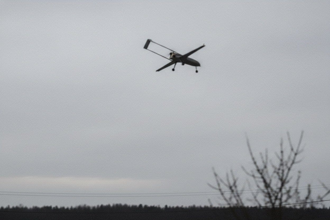
Moldova's defence ministry detected a drone from Ukraine at 16:24 local time on October 31, 2026, and lost it on radar at 16:54 near Țibirica, in Călărași District. AirVeto measures that spot 52.0 km in a straight line from central Chișinău.
The ministry reopened the airspace at 17:14. A second drone crossed the border 36 minutes later, at 17:50.
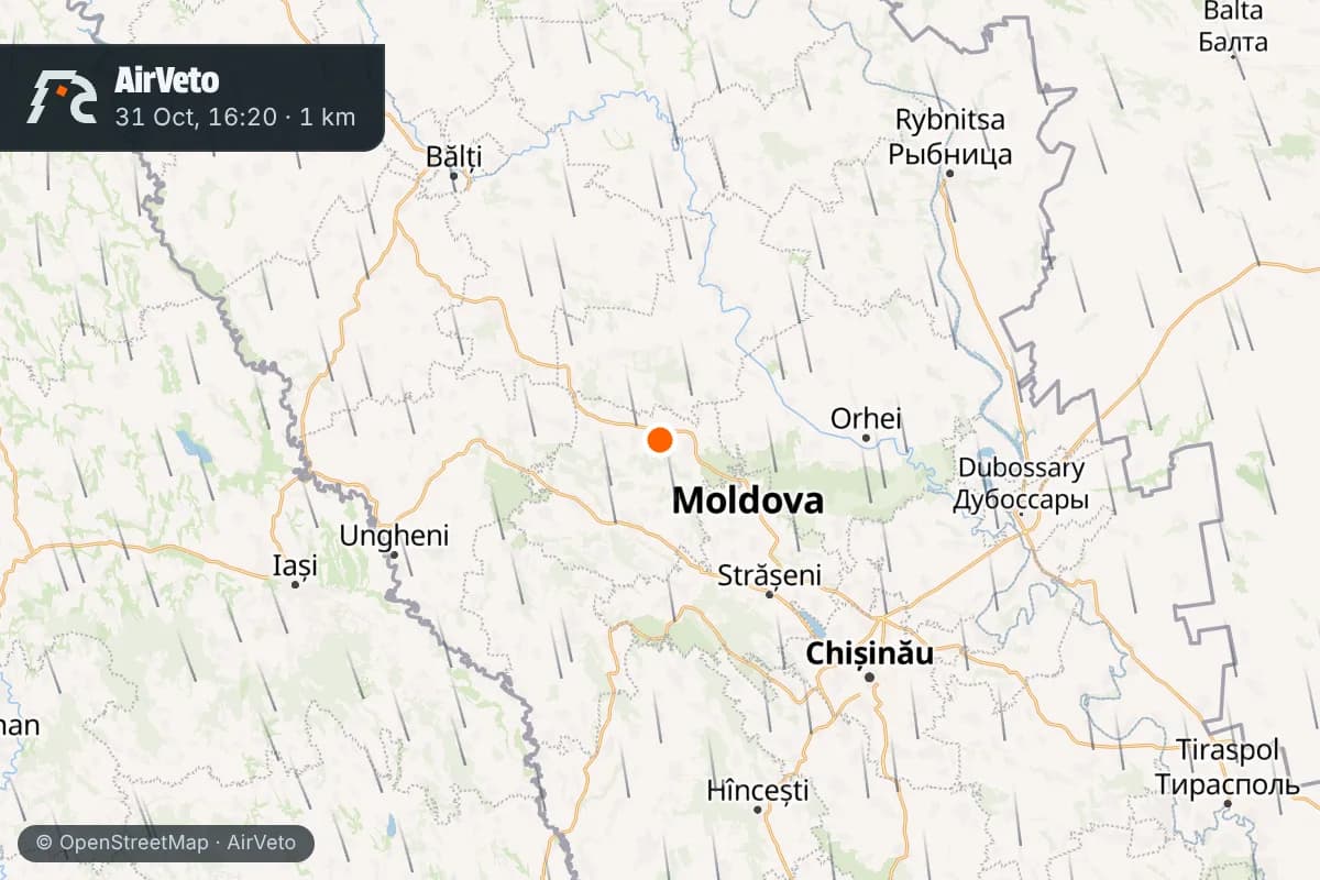
The first drone entered from Odesa region and left radar near Țibirica at 16:54
The ministry's Air Operations Centre logged the first flight at 16:24. The drone approached from Semionovca, in Ukraine's Odesa region. Its heading was Plopi, in Rîbnița District, in the Transnistrian segment. It was later located near Bănești, in Telenești District.
At 16:54 it vanished from radar near Țibirica. The ministry gave no object type for either drone. It said both overflights took place during large-scale Russian strikes on Ukraine.
Bănești lies 20.9 km, by AirVeto's measurement, from Chiștelnița, where a drone fell near a home on October 23. The ministry's October 31 release names no landing site for either aircraft.
Northern airspace closed 22 minutes after detection and reopened at 17:14
The ministry restricted airspace in the north at 16:46, 22 minutes after the first detection. It restricted the central zone at 16:52, two minutes before the radar track ended. Both zones reopened at 17:14, 20 minutes after the drone left radar.
The ministry asked residents not to touch any aircraft or fragments, which may carry explosives. It told them to note the spot, move at least 500 m away, avoid using a phone nearby and call 112.
The second drone crossed northern Moldova in 22 minutes
At 17:50 a second drone entered from the direction of Mihailovka, in Ukraine's Vinnytsia region, toward Sobor in Soroca District. The ministry then located it near the town of Dondușeni. At 18:03 it flew over the villages of Goleni, Gordinești and Burlănești, in Edineț District.
At 18:12 it left Moldovan airspace near Viișoara, in Edineț District. That is 22 minutes after it entered.
It is the 12th Moldova page in AirVeto's 2026 archive, and the third since October 16 in the Telenești and Dondușeni area
On October 16 a drone exploded at Codrenii Noi, in Dondușeni District. On October 23 a drone fell near a home at Chiștelnița, in Telenești District. On October 31 the first drone was located near Bănești in Telenești District, and the second passed near the town of Dondușeni.
Wind over Călărași District blew from the north at 1,000 m and from the west aloft
At 16:00 local time on October 31, the wind at 1,000 m blew from the N at 23 km/h. At 2,000 m it came from the NW at 21 km/h. At 3,000 m it came from the WNW at 25 km/h.
The drones' altitude is not reported. The hourly table under the map shows how the wind changed through the evening.
This reconstruction is based on the Moldovan defence ministry's releases, MOLDPRES, NewsMaker and IPN reporting, and AirVeto's wind-model data for the event window. How the model is built and where it is reliable is on the methodology page.
Sources
- Moldova Ministry of Defence - Informează! Second drone and airspace updates (31 Oct 2026)
- MOLDPRES - O dronă a survolat neautorizat spațiul aerian al Republicii Moldova (31 Oct 2026)
- MOLDPRES - O altă dronă a survolat neautorizat spațiul aerian în zona de nord (31 Oct 2026)
- NewsMaker - O dronă a intrat neautorizat în spațiul aerian al Republicii Moldova (31 Oct 2026)
- IPN - Second unauthorized airspace incursion recorded on Saturday (31 Oct 2026)
- IPN - A drone flew through the Republic of Moldova's airspace without authorization (31 Oct 2026)
- Methodology