
Tulcea drone alert, 12 Nov 2026 - 37 minutes
Romania sent a RO-Alert to north-east Tulcea County at 12:35 on November 12, 2026 after radar detected an air target 28 km north-east of Sulina, and two Spanish F-18s took off.
AirVeto finding: The 12 November alert in north-east Tulcea lasted 37 minutes, against 44 minutes on 9 November and 84 minutes for the first alert on 8 November.
Evidence behind the finding2 confirmed1 modelled1 unknown
- confirmedThe ministry's radar detected an air target about 28 km north-east of Sulina, two Spanish F-18s took off, and the RO-Alert went out at 12:35.DailyBusiness
- confirmedThe ministry gives the end of the air alert as 13:12.DailyBusiness
- modelled13:12 minus 12:35 gives 37 minutes, against 44 minutes on 9 November and 84 minutes for the first alert on 8 November.DailyBusiness
- unknownWhat the target was and whether it entered Romanian airspace; none of the reports AirVeto read says.
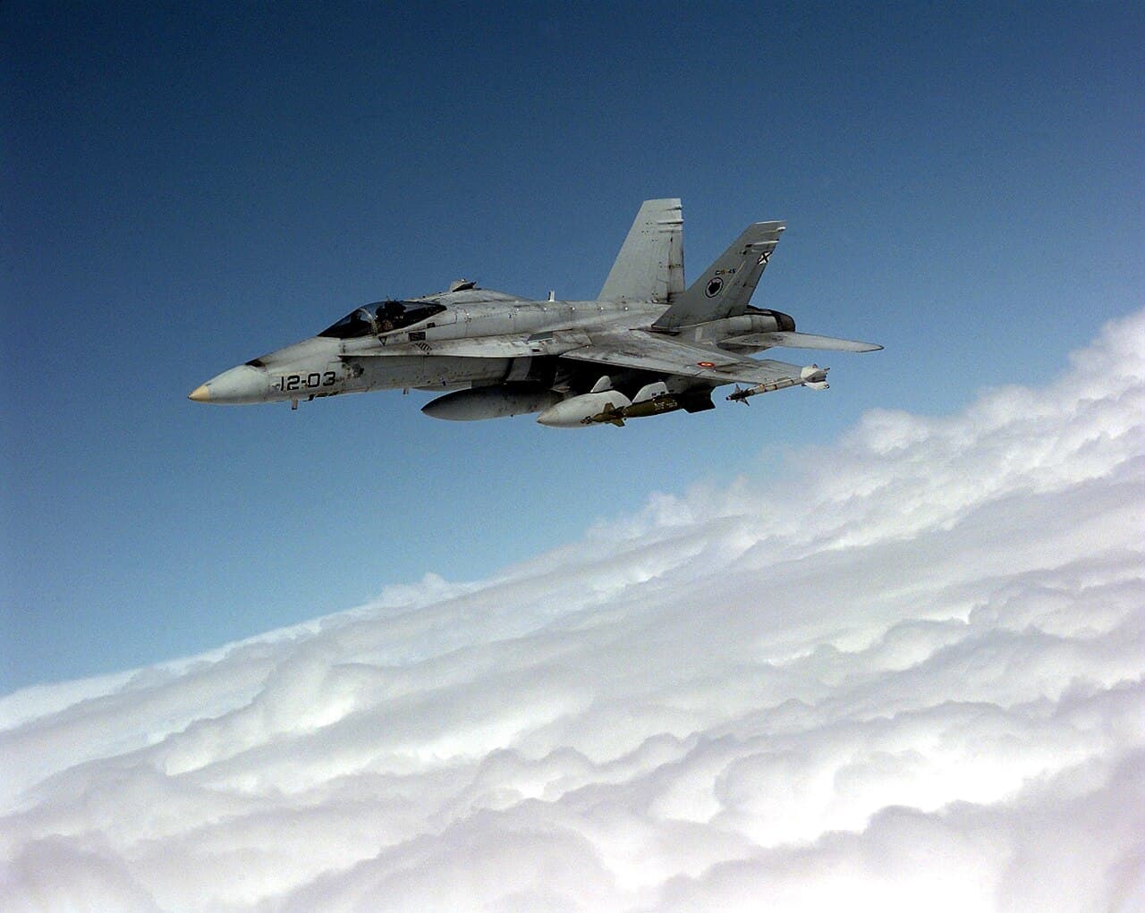
Romania sent a RO-Alert to north-east Tulcea County at 12:35 local time on Thursday, November 12, 2026, after the defence ministry's radar detected an air target about 28 km north-east of Sulina. Two Spanish F-18s took off to monitor it, DailyBusiness reported, and the ministry ended the alert at 13:12.
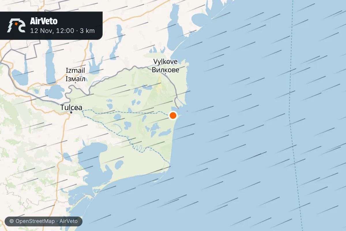
The ministry's radar picked up a target 28 km north-east of Sulina
DailyBusiness, citing the ministry, reported that the national military command centre notified the emergency inspectorate, which sent the RO-Alert. The message, as Digi24 carries it, told residents to take cover in cellars or civil-protection shelters, or to stay indoors away from windows and outer walls.
Radio Romania Constanta added that the radar showed the target near the border. It said residents were warned that objects could fall from the air. No report AirVeto read names the object or says whether it entered Romanian airspace.
Residents were told to shelter for 37 minutes
The alert ran from 12:35 to 13:12, which is 37 minutes. That is shorter than the 9 November alert, which lasted 44 minutes by one outlet's account, and the first alert on 8 November, which lasted 84 minutes. The ministry put the 9 November target 30 km north-east of Sulina, almost where it put this one.
Romania TV counted this as the seventh RO-Alert for Tulcea residents since the start of November. The evening before, on November 11, residents of the north of the county got another one after the authorities identified a drone approaching the border, Digi24 reported.
The wind at 3,000 m over Sulina
AirVeto's wind model gives the center-point wind over Sulina at 12:00 local time, shortly before the RO-Alert. At 2,000 m the wind blew from the WSW at 59 km/h. At 3,000 m it also came from the WSW, at 64 km/h.
| Altitude | Wind from | Speed |
|---|---|---|
| 2,000 m | WSW | 59 km/h |
| 3,000 m | WSW | 64 km/h |
This reconstruction rests on the defence ministry's times and figures as DailyBusiness carries them, plus reporting from Radio Romania Constanta, Digi24 and Romania TV, and AirVeto's wind-model data for the event window. How the model is built is on the methodology page. Every drone and airspace event AirVeto has reconstructed along the EU's eastern border is in the incident archive.
Sources
- DailyBusiness - Tulcea: Alerta de drone pentru zona de nord-est a judetului (12 Nov 2026)
- Radio Romania Constanta - TULCEA: Mesaj RO-Alert de drone pentru nord-estul judetului (12 Nov 2026)
- Digi24 - Mesaj RO-Alert pentru locuitorii din Tulcea, dupa detectarea unor posibile drone (12 Nov 2026)
- Romania TV - O noua alerta pentru locuitorii din Tulcea (12 Nov 2026)
- Digi24 - RO-Alert pentru locuitorii din nordul judetului Tulcea (11 Nov 2026)
- Methodology