
Tulcea drone alerts, 8 Nov 2026
Romania sent RO-Alerts to eastern and northern Tulcea County on November 8, 2026 as Spanish F-18s, NH-90 helicopters and Romanian F-16s took off, the defence ministry said.
AirVeto finding: The ministry's two radar points of the afternoon sit very differently against Sulina: the first target, 30 km east of Snake Island, was about 74 km from the town, and the second, 55 km west of the island, about 16 km.
- confirmedThe defence ministry placed the first target about 30 km east of Snake Island and the second about 55 km west of it.Radio Romania ConstantaHotNews
- modelledMeasured from Sulina, the first point is about 74 km away and the second about 16 km, taking east and west as due east and due west.Radio Romania Constanta
- unknownWhich airspace the second target was in is not stated: the ministry names Ukrainian airspace for the first and third targets only.

Romania sent RO-Alert warnings to eastern and northern Tulcea County on Sunday, November 8, 2026, after the defence ministry's radar picked up air targets near the Ukrainian border. By AirVeto's approximate measurement, the first target lay about 74 km from Sulina. The second lay about 16 km from the town.
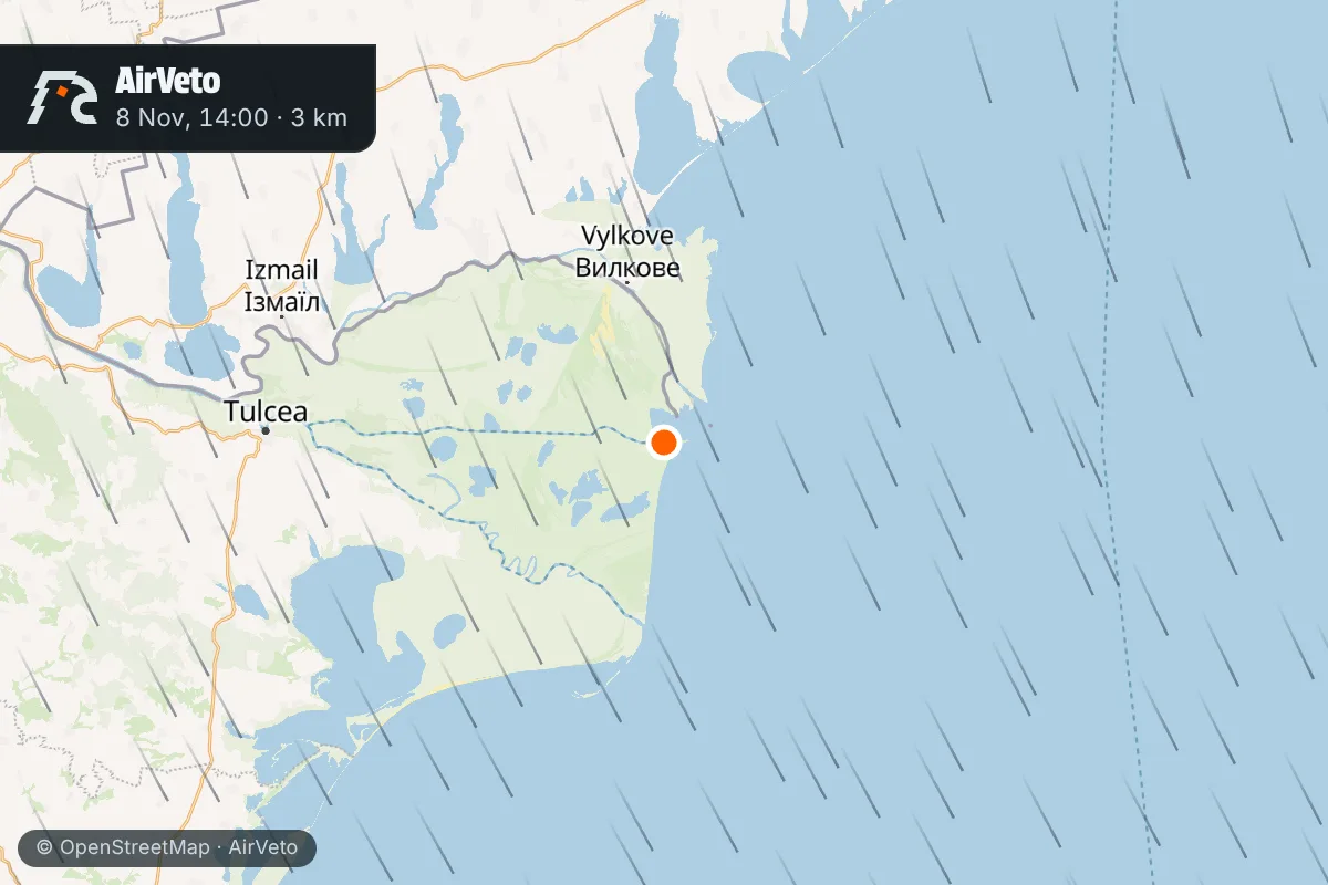
The first alert reached eastern Tulcea at 14:02 local time
The ministry's radar detected an air target about 30 km east of Snake Island, in Ukrainian airspace, Radio Romania Constanta reported, citing the ministry. Two Spanish F-18s on air-policing duty took off from Mihail Kogalniceanu Air Base, and a RO-Alert went to eastern Tulcea County at 14:02. The first target then vanished from radar east of Sulina.
The county's emergency service, ISU Delta Tulcea, said the message covered only the east of the county and that no calls reached the 112 emergency line.
A second target 55 km west of the island brought out two helicopters
The radar then picked up a new target about 55 km west of Snake Island, and two Spanish NH-90 helicopters took off from the same base, HotNews reported. The ministry's wording, as the outlets carry it, gives no airspace for this second target. The air alert ended at 15:26.
Taking "west" as due west, that point lies about 16 km from Sulina, against about 74 km for the first point taking "east" as due east.
A third alert reached northern Tulcea in the late afternoon
Later a RO-Alert went to the north of the county, classed as an extreme alert and warning of a possible drone incursion, according to TLnews, citing ISU Tulcea. The ministry said radar had detected a new target in Ukrainian airspace about 4 km north of Chilia Veche, near the Romanian border. Two Romanian F-16s on air-policing duty took off from Fetesti Air Base.
Realitatea reported, citing the ministry, that this alert ran from 16:51 to 17:59 and counted it as the third RO-Alert of the day. The reports AirVeto read mention take-offs and the loss of the first target from radar, and report no shoot-down.
Two October events at Sulina ended differently
On October 14 the ministry reported two kills off Sulina made by Ukrainian air defence, after the targets had left Romanian airspace. On October 17 Romanian F-16s shot down two Geran-family drones in territorial waters off the town.
The wind at 3,000 m over Sulina blew from the north-northwest at 54 km/h
AirVeto's wind model gives the center-point wind over Sulina at 14:00 local time, when the first alert went out.
| Altitude | Wind from | Speed |
|---|---|---|
| 500 m | W | 15 km/h |
| 1,000 m | WNW | 16 km/h |
| 2,000 m | NNW | 36 km/h |
| 3,000 m | NNW | 54 km/h |
By 17:00 local time, during the third alert, the wind at 3,000 m was still from the NNW at 58 km/h. Directions are where the wind blew from.
This reconstruction is based on the Romanian defence ministry's statements as carried by Radio Romania Constanta, Realitatea, HotNews and TLnews, and on AirVeto's wind-model data for the event window. How the model is built is on the methodology page. Every drone and airspace event AirVeto has reconstructed along the EU's eastern border is in the incident archive.
Sources
- Radio Romania Constanta - TULCEA: Dubla alerta aeriana cu drone in apropiere de Insula Serpilor (8 Nov 2026)
- Realitatea.NET - Trei mesaje RO-Alert in judetul Tulcea (8 Nov 2026)
- HotNews - Drone detectate langa Insula Serpilor (8 Nov 2026)
- TLnews - Alerta in nordul judetului Tulcea (8 Nov 2026)
- Methodology