The Suwałki Gap is the roughly 65-kilometre land corridor linking Poland to Lithuania. It is the only land connection between the three Baltic states (Lithuania, Latvia, Estonia) and the rest of the European Union — to its east is Belarus, to its west is the Russian exclave of Kaliningrad. For anyone monitoring the EU's eastern frontier, the gap is a compact geographic test case: two hostile borders, one narrow passage, and a wind field that frequently moves air from one side to the other.
On AirVeto, the gap is where the orange-border inflow-detection logic pays off most directly. A segment on the Lithuanian-Belarusian frontier turns orange when the wind vector is currently crossing into Lithuania within 85° of the border-normal; a segment on the Polish-Russian frontier turns orange when wind is crossing from Kaliningrad into Poland. Both can happen simultaneously, and when they do, the gap becomes an inflow funnel for airborne objects released on either side.
A narrow corridor also means that a single synoptic system (a passing front, a stationary high) dominates the entire gap. You rarely see the northern end and southern end in genuinely different wind regimes. Kaliningrad's wind field, in particular, is usually correlated with the adjacent Polish-Lithuanian coast — reason enough to read the Polish side of the gap as a proxy for the Kaliningrad interior when that matters.
The gap has been the focal point of repeated airspace events in 2025–2026, including smuggling-balloon activity along the Lithuanian-Belarusian portion and airspace closures at Vilnius International Airport (30 km north of the gap's Lithuanian end). The specific closures are documented in the incidents listed below.
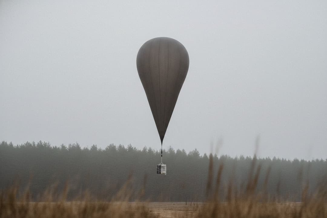
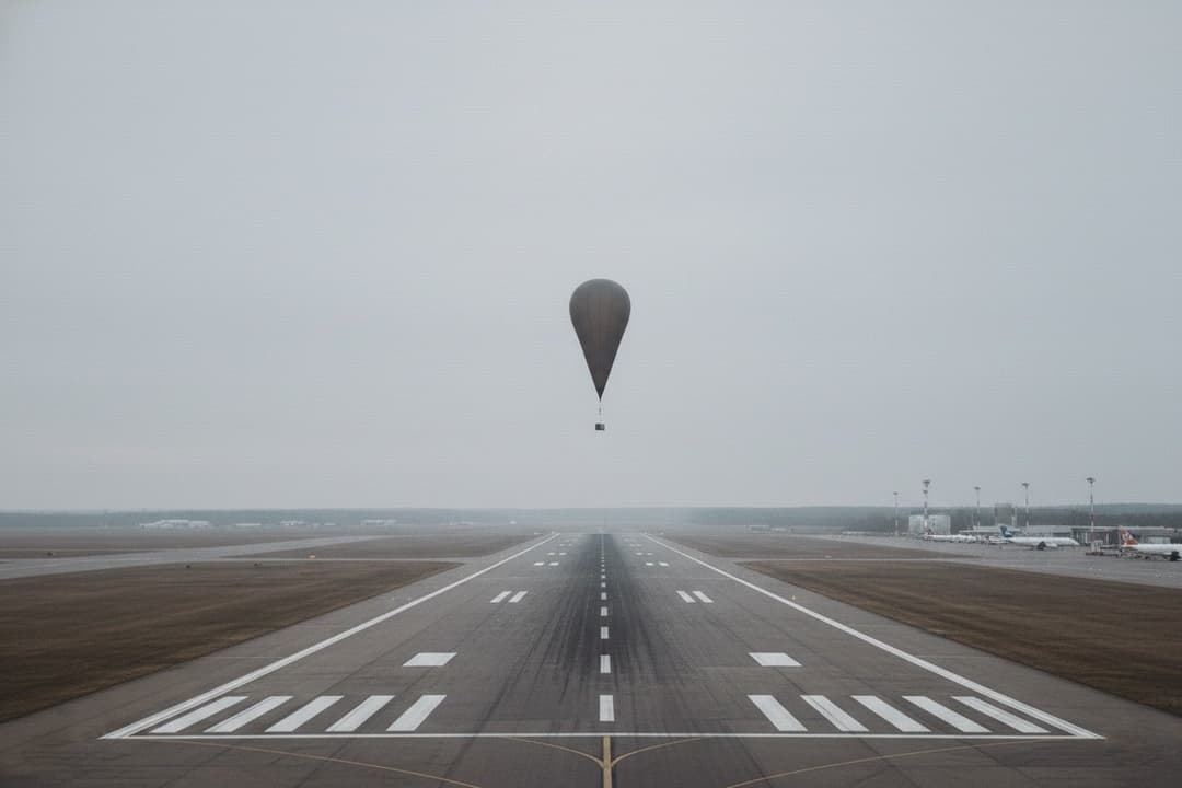
Altitude selection matters across the gap. Smuggling balloons released on the Belarusian side typically cruise between 2,000 m and 8,000 m, so the inflow reading that matters is the mid-troposphere field rather than the surface wind — boundary-layer flow near the ground is lighter, more variable, and often decoupled from the air that actually carries an object across the corridor. The 3,000 m layer is the working default for balloon-drift reasoning; switch higher when a sighting reports a fast crossing, lower only for short-range objects that never climbed out of the boundary layer.
For an analyst, the gap view answers one question precisely: in the hours around a reported incursion, was the wind at cruise altitude oriented to carry something from one hostile border across the corridor and onto EU territory? An orange border segment means the geometry allowed it — it does not confirm anything was airborne. Read alongside the reconstructed incidents listed below, the hub turns a single day's wind field into a record a report can be anchored against.
The gap view is regional context, not a trajectory model. AirVeto renders the wind field that a dispersion model would ingest; it does not compute point trajectories. For questions of where an object released here would come down, the wind layer is the upstream input — the trajectory itself is the work of a dedicated model.
Incidents at this location
- 🇱🇹 · 2026-01-28 · Vilnius International Airport
Vilnius Airport balloons - 28 Jan 2026, 8 intercepted
Eight balloons entered Lithuanian airspace near Vilnius Airport at 03:00 UTC on 28 January 2026; four suspects were arrested. AirVeto's 7 km wind log shows ~71 km/h southerly flow from Belarus. - 🇱🇹 · 2026-04-09 · Vilnius International Airport

Vilnius Airport closed by balloons - 9–10 April 2026
Vilnius Airport (EYVI) was closed for almost seven hours on 9–10 April 2026 after suspected smuggling balloons entered approach airspace from the Belarusian direction. - 🇱🇹 · 2026-06-07 · Vilnius International Airport
Vilnius airport closure, 8 June 2026 - 5 flights
Belarusian balloon markers closed Vilnius Airport from 01:18 to 04:00 EEST on 8 June 2026, disrupting five flights and 453 passengers; four aircraft were diverted, including two to Kaunas. - 🇱🇹 · 2026-02-06 · Druskininkai
Druskininkai balloons - 7 intercepted, 6 Feb 2026
Seven balloons were intercepted and two individuals arrested in the Druskininkai area on 6 February 2026 - a daily record for Lithuania in 2026. - 🇱🇹 · 2026-05-19 · Trakai district
Trakai contraband balloons - 19 May 2026
Two smuggling balloons carrying contraband cigarettes came down near a lake in Trakai district before dawn on 19 May 2026, a few houses from Seimas member Edita Rudelienė's home. - 🇱🇹 · 2026-05-12 · Lauryno Ivinskio Street
Kaunas Šančiai contraband balloon - 13 May 2026
A balloon carrying ~9,000 cigarette packs landed in Šančiai, Kaunas, on 13 May 2026; the ICON wind field shows sustained southerly flow from the Hrodna (Grodno) oblast of Belarus. - 🇱🇹 · 2026-06-10 · Puvočiai field base
Puvočiai balloon payload - Varėna, Jun 2026
Vilnius University geography students discovered a contraband balloon payload at the Puvočiai field base in Varėna district during field practice in June 2026. - 🇱🇹 · 2026-07-07 · Druskininkai
Druskininkai - four drones intercepted, 7 July 2026
Lithuanian border guards landing four smuggling drones at once carrying 5,000+ packs of Belarusian cigarettes - the largest simultaneous drone interception in VSAT operational history. - 🇱🇹 · 2026-07-09 · Padvarioniai outpost area
Padvarioniai two-drone interception, 9 July 2026
VSAT officers at the Padvarioniai outpost intercepted two contraband drones from Belarus on Thursday night, 9 July 2026, recovering 2,000 packs of Queen Menthol cigarettes worth €10,920. - 🇱🇹 · 2026-07-09 · Prūdelis
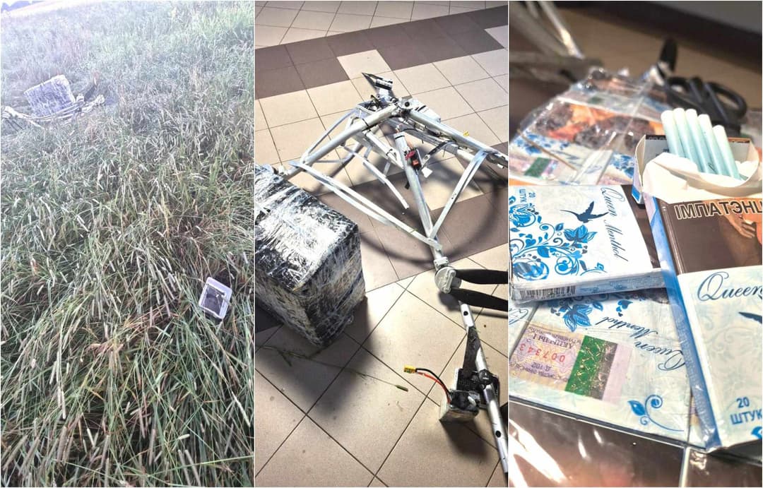
Prūdelis contraband drone intercepted, 9 July 2026
VSAT border guards at Prūdelis village used anti-drone equipment to take over a cigarette-smuggling drone from Belarus. After the control signal was overridden, the drone crashed to the ground. - 🇱🇹 · 2026-07-12 · Daugidoniai village
Daugidoniai Belarus drone downed, 12 July 2026
Lithuanian border guards intercepted a contraband drone from Belarus near Daugidoniai village on Sunday, 12 July 2026, recovering 200 packs of NZ Gold cigarettes worth €1,102.
Related reading


Methodology: see /about/methodology. AirVeto is not for aviation, navigation, or safety-critical decisions.