
Gallant Boar 2026: NATO Exercises the Suwałki Gap This Week
Lithuania, Poland, and France run joint drills in the Suwałki Gap June 16–26. What the exercise covers, why the gap still defines Baltic defence planning, and what the wind looks like over it this week.
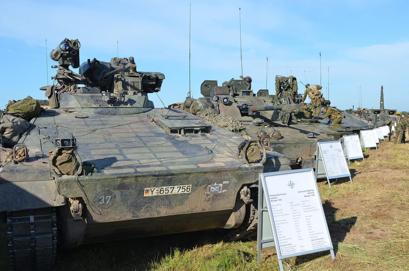
Starting Monday 16 June, the Suwałki Gap becomes a live exercise zone. International drills codenamed Gallant Boar 2026 ("Narsus Šernas" in Lithuanian) run through 26 June in the narrow strip of land near the Lithuanian-Polish border. Lithuanian, Polish, and French ground forces are participating: specifically, soldiers from Lithuania's Grand Duke Butigeidis Dragoon Battalion of the Žemaitija Infantry Brigade, training alongside their Polish and French counterparts.
The stated objective is joint operations and synchronisation. That covers a lot of ground. Command interoperability, cross-national logistics, the kind of real-terrain familiarity you can only build by moving equipment through the gap.
The convoy route
Before the exercise opens, heavy military equipment moves by road: Klaipėda → Kryžkalnis → Kazlų Rūda → Marijampolė → Suvalkai, beginning Saturday morning. That's roughly 300 km from Lithuania's Baltic port to the Polish border, crossing the full width of the country. Civilian traffic in those districts should expect delays.
The geography here matters for more than logistics. Klaipėda sits on the Baltic coast, where land-sea temperature contrast in June creates boundary-layer wind shear. Low-altitude flow can differ markedly from what's happening 50 km inland. By the time equipment reaches Marijampolė, the terrain has opened into the flat agricultural land typical of the gap's wind field, which runs almost entirely on synoptic-scale flow with minimal terrain braking.
Why exercising the gap is different
Most NATO exercises run in large, defined training areas. Gallant Boar runs in the gap itself. The 65 km of land between Belarus and Kaliningrad is the only ground link between the Baltic states and the rest of the EU. That's not an abstraction. Exercising here is a signal about familiarity: these forces know the terrain, the logistics, what cross-border coordination looks like on this specific ground.
France's participation is the one worth watching. French forces have been in Lithuania since the Enhanced Forward Presence battalion deployed to Rukla. A French unit in a gap-specific drill is a more deliberate commitment than general EFP presence. Poland's involvement is the obvious piece: the southern half of the gap is Polish territory, and any defence of it is inherently a joint Lithuanian-Polish operation.
What they tested on the ground: a robot called GOBLIN
The three armies didn't only move tanks and artillery through the gap. They also ran a Polish-built ground robot through it, named GOBLIN. A Warsaw company called Macro-System makes it. It's the kind of machine built for the jobs you'd rather not send a person to do first: scouting ground the other side is watching, and pulling wounded soldiers out from under fire.
GOBLIN is a ground machine, not an airborne one, and it was tested in this gap during this exercise: a detail worth filing next to the airborne systems in the same drills. The recon drones flying over the same exercise are the ones with a wind picture to reconstruct.
What the wind looks like this week
I track this gap's wind field closely, so it's worth being specific.
The Suwałki Gap sits at a meteorological junction. At 54-55°N in mid-June, the jet stream sits well north and synoptic forcing is weaker than in winter, but the gap's flanking geography still shapes local flow. Belarus to the east, Kaliningrad to the west, the Baltic coast less than 150 km to the north-northwest.
This week: post-frontal flow pushing east after Saturday's system, backing to push toward the northeast later as a high builds over Scandinavia. At exercise altitudes (ground to 500 m), winds will be lighter than recent weeks. The June 11 orange-warning squall that pushed 25 m/s through this same zone has passed. Clear-air exercise windows look good, though the backing flow toward the northeast may bring low cloud and reduced visibility to the Marijampolė end by mid-week.
For drone operations in the exercise, the relevant layer is 80-500 m. At that band, the post-frontal flow is pushing east, meaning anything airborne drifts toward Belarus. That has real operational implications for recovery planning and for any unintended excursions past the exercise boundary.
For how the gap's wind field behaves across seasons, see Reading the Suwałki Gap. For the gap's full geography, incident archive, and a live-map deep link, see the Suwałki Gap location hub.
The backdrop
Gallant Boar is one of the Baltic region's major scheduled exercises this year. It arrives after a spring of real airspace incidents: drones, and most recently a meteorological balloon from Belarus that triggered a yellow-level air alert in Vilnius district on 13 June. The exercise doesn't respond directly to any of that. But it happens against the same backdrop: a gap that every Baltic defence planner treats as the terrain where a real confrontation would be decided.
Allied forces are increasingly serious about knowing that terrain from the ground up. That's what these drills are.
The full Baltic airspace incident archive is at incident archive. The Suwałki Gap wind layer is on the live map.
Sources
- 15min.lt - Lietuvos kariai dalyvaus tarptautinėse pratybose šalia Suvalkų koridoriaus (mid-June 2026, citing the Lithuanian Armed Forces directly - exact publish date not captured in fetch)
- The Defence Blog [EN] - Polish combat robots train to hold the Suwałki Gap (Jun 2026)
- 15min.lt [LT] - Prie Suvalkų koridoriaus išbandytas kovinis robotas GOBLIN: ką jis gali (27 Jun 2026)