The Polish-Belarusian border runs for approximately 418 kilometres, from the northeast at the tri-border with Lithuania to the southeast at the tri-border with Ukraine. It is the EU's longest land frontier with Belarus and has been the focal point of migration, airspace, and cross-border incident reporting since the 2021 migration crisis. The Podlaskie Voivodeship, around Białystok, is the middle section — and the one most frequently referenced in recent airspace events.
On AirVeto, the Polish side of the Belarusian frontier is where orange inflow segments surface during the recurring cross-border balloon and drone reports. The 85° border-normal threshold is particularly informative here because the border runs broadly north-south, so easterly wind components are directly compatible with inflow — as opposed to, for example, the Lithuanian-Belarusian frontier where the border turns and the wind-geometry relationship is more varied.
Incidents along this frontier include the Christmas 2025 window in Podlaskie (see the incident archive), repeated drone and balloon reports throughout 2025 and 2026, and a standing Polish military presence. The live map at this hub deep-links the AirVeto view to the segment centred on the Białystok area.
The Podlaskie section around Białystok is the part of the frontier to watch. Its broadly north-south orientation makes the wind geometry unusually legible: an easterly component is, almost by definition, inflow, so a sustained easterly across the region for hours at a time gives any release on the Belarusian side a drift envelope pointing straight into Poland. That is why AirVeto's December 2025 reconstruction of the Christmas window could flag the corridor before the recoveries were reported — the geometry, not a forecast, did the work.
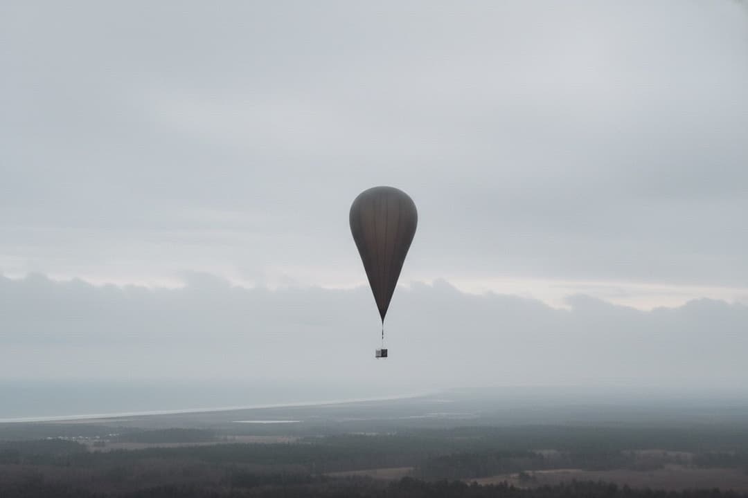
Altitude guidance here matches the rest of the frontier. Smuggling balloons cruise well above the surface, so the inflow reading that matters is the mid-troposphere field, with 3,000 m as the working default. The boundary-layer wind near the ground is lighter and more variable, and reading it in place of the cruise-altitude flow is the most common way to misjudge whether a crossing was physically possible.
For journalists and analysts covering the frontier, the hub's role is to put a specific day's wind field on the record. An orange segment confirms the corridor was open; it does not confirm a crossing. Paired with the reconstructed incidents below, it lets a story anchor on a wind situation that already existed at the time of the event, rather than one described after the fact.
Incidents at this location
- 🇵🇱 · 2025-12-24 · Podlaskie Voivodeship
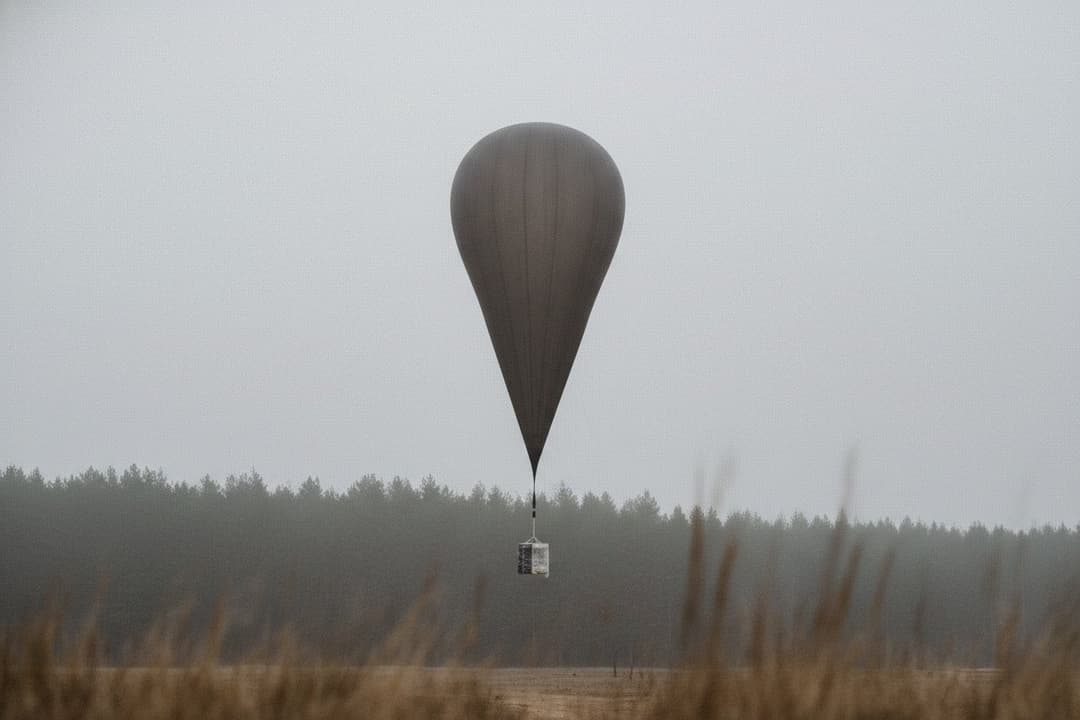
Białystok balloons from Belarus - 24 Dec 2025
On 24 December 2025, AirVeto's model flagged a Belarus→Poland crossing zone; Polish authorities overnight recovered four smuggling balloons - the first documented AirVeto prediction match. - 🇵🇱 · 2026-01-21 · Sokółka County
Belarus balloons, Podlaskie, Jan 2026 - airspace closed
Polish military radar detected Belarusian smuggling balloons crossing into Podlaskie on the night of 21 January 2026; Poland summoned the Belarusian chargé d'affaires on 22 January. Three consecutive nights of crossings on 31 January–2 February triggered emergency NOTAMs; five smugglers were arrested on 5 February 2026. - 🇵🇱 · 2025-09-09 · Wyryki-Wola

Wyryki-Wola missile impact, 9 Sep 2025 - Poland drone raid
During Russia's 9–10 September 2025 mass drone incursion into Poland - 19–23 decoy drones, the first NATO shots since the full-scale invasion began - a Polish F-16's AIM-120 AMRAAM suffered a guidance failure and struck a residential building in Wyryki-Wola, Włodawa County. The 150 kg missile did not detonate. It was the first time in the war that a NATO air-defence missile caused structural damage inside a NATO state. - 🇵🇱 · 2025-08-19 · Osiny

Osiny Shahed crash, 20 August 2025 - 2.5h undetected
A Russian Shahed drone with a Chinese MD550 engine crashed at approximately 02:00 CEST on 20 August 2025 in Osiny, Łuków County; the drone flew over Polish territory for 2.5 hours undetected before crashing.
Related reading


Methodology: see /about/methodology. AirVeto is not for aviation, navigation, or safety-critical decisions.