
Wind reconstruction for what just crossed the border.
AirVeto reconstructs where airborne objects drifted from, using Open-Meteo wind data at the altitude and time of each crossing. Border agencies use it to establish probable release-zone estimates for balloon incursions and to document atmospheric conditions during drone interdictions.
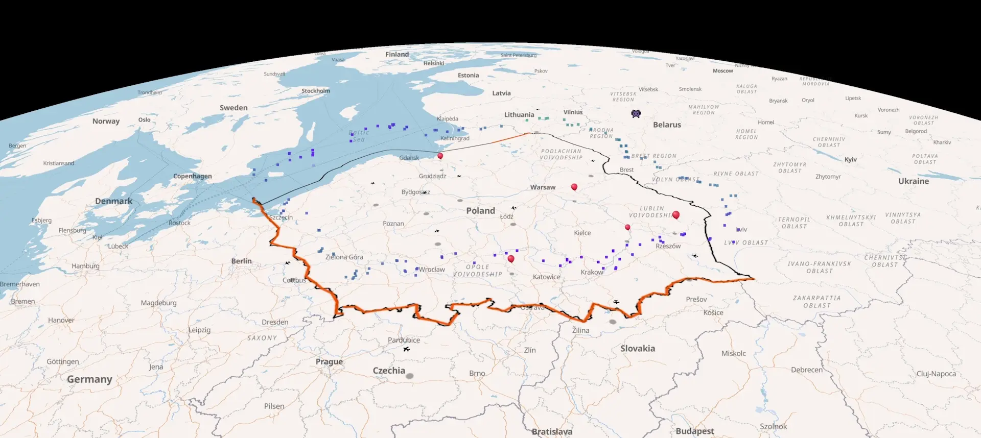
Recent cross-border balloon and aircraft incidents.
Every reported incursion since December 2025 - launch coordinates, the wind field at the time, drift trajectory, landing point. Source-linked. Each entry is its own page; deep-link any timestamp to the live map at the event location.
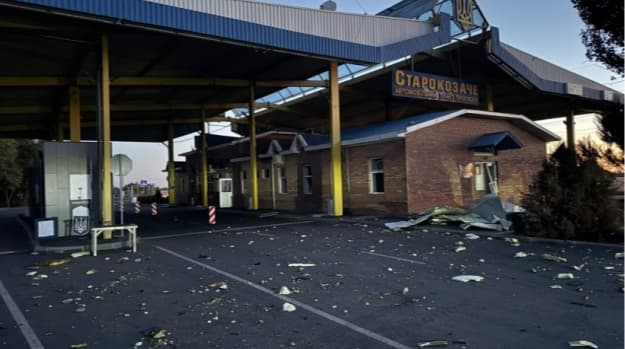
Starokozache border crossing drone strike, 9 Sep 2026
Russian drones struck the Starokozache checkpoint on Ukraine's border with Moldova overnight, killing two civilians and wounding three on 9 September 2026.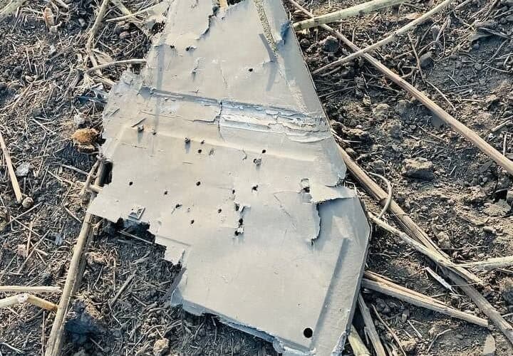
Russian drone delays Zelenskyy, sets off RO-Alert
A Russian drone crossed Moldova into Romania and crashed near Mihăileni Vechi on 8 September 2026, closing Moldovan airspace and delaying Zelenskyy's flight to Oslo.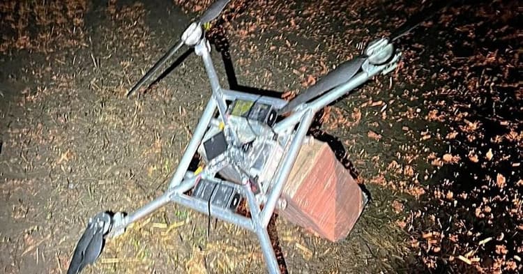
Daugidonys drone, September 6, 2026 - 55th intercept of 2026
VSAT downed a homemade drone from Belarus near Daugidonys, Šalčininkai district, on September 6, 2026. Cargo: 1,000 packs NZ Gold cigarettes, €5,510. The 55th drone interception of 2026.Release-zone estimation for balloon incursions.
Wind-drift balloons travel on the ambient wind from the release point to the recovery or crossing point. AirVeto reconstructs the wind field at the altitude the balloon rode and the time it crossed the boundary - providing a probable release-zone estimate on the other side of the border.
The EU eastern border archive covers over 50 documented balloon incursions across Lithuania-Belarus, Poland-Belarus, Latvia-Russia, Estonia-Russia, and Romania's Black Sea frontier. Each incident includes wind field data at the event altitude and time window. Key segments:
- Poland-Belarus border - balloon and drone incursion archive
- Vilnius Airport - balloon closure incident log
- Suwałki Gap - corridor context and incident coverage
- NATO eastern flank - broader airspace incident context
- 50+
- Airspace incidents on EU eastern border
- 8
- Altitude layers for crossing reconstruction
- 1h
- Open-Meteo wind data update cadence
Cross-incident pattern analysis.
AirVeto maintains an archive of over 50 documented airspace incidents on the EU eastern border. Agencies can compare wind conditions across multiple events to identify recurring release points, seasonal patterns, or consistent methods. When the wind at crossing point X on three separate dates all traced back to the same release corridor, the pattern is in the data.
For drone events, wind reconstruction does not reconstruct the origin route - powered autonomous drones navigate independently of wind. AirVeto provides the atmospheric conditions at the interdiction point and altitude, supporting the investigation record without overclaiming.
Custom sensor overlay for border posts.
Border monitoring teams running their own sensor networks - radar stations, ground observation posts, drone detection hardware - can connect those feeds to AirVeto via the custom data API. Any HTTPS endpoint returning the standard JSON schema overlays as real-time points on the wind map. Detection events, unit positions, and sensor readings appear alongside the wind reconstruction in one view.
Custom data overlay is a Companies plan feature. See the technical documentation for the API schema and CORS requirements.
Team accounts for shift operations.
Companies plan users get a shared organisation account. Multiple operators or shift personnel access the same AirVeto account - useful for 24-hour border monitoring posts where different people need the same operational picture across a shift cycle. Invoice billing is available for public-sector procurement.
For border monitoring deployments with specific requirements - multi-site coverage, custom data integrations, dedicated onboarding - contact hello@airveto.com directly. We scope Companies deployments individually.
Discuss your deployment requirements directly.
We scope Companies deployments individually. Tell us your border segment, team size, and whether you need custom sensor integration.